Since I started writing articles on my blog, I always felt that it would be nice if I can share the information and photos about the tourism spots I visit. After moving to Bengaluru (Karanataka), I had visited lot of places which I don't know till I visited. I mostly depend on Google search and some websites like tripadvisor, makemytrip etc. These sites along with Google can only give you idea of in and around tourist attractions of particular place but no other details. Hence I wanted to start writing articles on them in detail. The first one will be Chikmagalur tour that covers Shravanabelagola, Halebidu, Belur Bhadra Wild Life Sanctuary, Peaks and water falls in the forest. I inserted hyperlinks for more information in the article (Grey Colour), kindly use them for your reference.
Chikmagalur is district head quarters of Chikmagalur district in Karnataka state. It is located at distance of roughly 250 Kms. It is also called land of Coffee. Coffee beans supplied to Coffee Day outlets are cultivated here. It is richly surrounded by mountainous forest, beautiful sceneries and also home to tigers, leopards, samba deer thats constitutes the Bhadra wild life sanctuary. You can find more about Chikmagalur here Chikmagalur Wiki or their Government Website.
Day 1
We started our tour on day 1 at 8 AM in Bengaluru. We were supposed to be start early by 6 AM, the actual cab we booked was allotted to some other people and the cab provider said he can arrange cab before 8 AM. We are unhappy as we planned for only 2 days (1 night) and we are losing 2 hours of valuable time and most importantly it spoiled the mood. The cab driver able to make it before 8 AM. We took Bengaluru-Mangalore highway NH-48 from ORR via Hebbal.
Shravanabelagola (Gomateswara Temple)
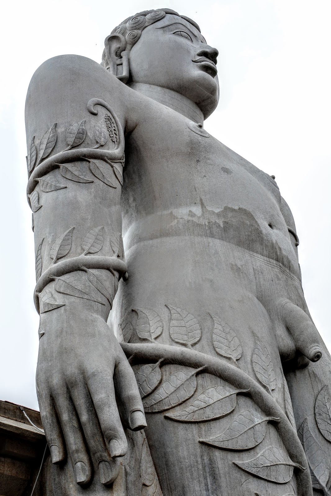
En route Chikmagalur we covered various historic temples. We first stopped at Gomateswara temple at Shravanabelgola around 11 AM. The temple is located on a mono-rock hill. You have to take approximately 700 steps to reach the temple and the statue. There is no other way to reach it other than taking steps. For old age people there is a Palanquin (pallaki kind of) to carry them to top, they charge approximately 1200 rs for one trip.
 |
| Bahubali Statue |
It is advised to visit the temple during the morning time as we felt it extremely hot during our journey to the top of hill. You should also carry some snacks as nothing is available on the hill except drinking water, even no prasadam. It consumes roughly two hours time. Coming to the the temple, it was built in 970-1000 AD. The main attraction of the temple is the monolith statue of warrior Bahubali which is 57 ft height.
 |
| Me at the temple |
 |
| 57 feet monolith Bahubali statue |
 |
| A view of the Temple and nearby vicinity from top |
 |
| The white pond at the bottom of temple hill |
You can see the village and nearby vicinity from the top of the hill along with the white pond (Koneru) down of the temple hill. The "white pond" supposed to be, turned green due to algal contamination ! The temple is of most interest to Jains. There are total 5 such statues in Karnataka state.
Halebidu
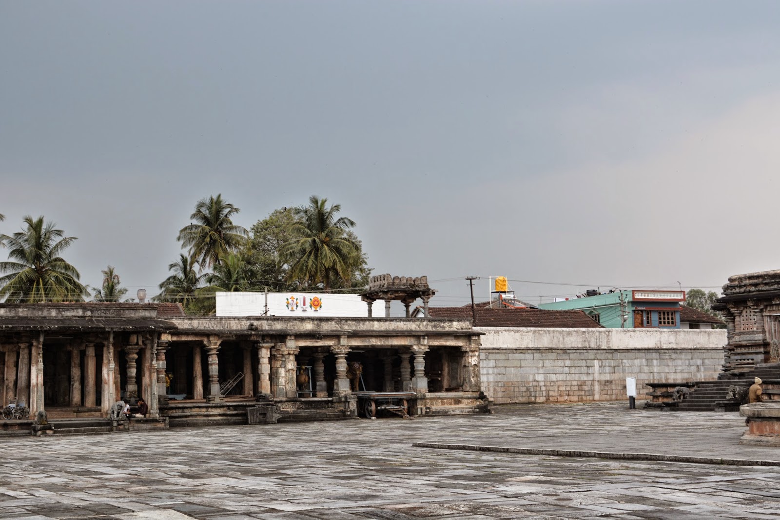
We had lunch break at Kamat hotel on NH-48. After lunch we headed to Halebidu and reached there by around 3 PM in the afternoon. I am very much exited to see this as it is one of the temples of Archaeological interest in India.

The temple was built around 1100 AD. It is wealth of sculptures & carvings inside and outside the walls of temple

No two other carvings are same. You can not stop praising the artistic taste of Hoyasala Kingdom.
 |
| South Entrance |
 |
| Various Hindu gods carvings |
 |
| Nandi at Halebidu |
 |
| Various Indian Gods on the walls |
It took almost 86 years to built it !. Its better to hire a guide if you want to know more details of each carving. The sad part of the temple is, people are not supposed to touch it but almost everyone is taking photographs by placing hands, legs etc on it. Some of the carvings are already damaged. Govt. of Karnataka should take care of this, as it is already proposed to have UNESCO world heritage site status. There is also an Archaeological museum which we did not visit. See the photos.
Belur
We moved on to Belur, a small municipal town in Hasan district of Karnataka State and reached it by around 5 Pm. It is 16 kms from Halebidu but the road is very bad and takes at least 40 mins of time. Belur is originally the first capital of Hoyasala empire, which later moved to Halebidu. The major attraction is the Chennakesawa Swamy temple which looks strikingly similar to Helabidu temple from outside.
 |
| Side view of the temple |
 |
| Postures of various goddess inside the temple |
 |
| Elephant, Lion and Horse carvings on the walls of temple |
We are supposed to halt at Chikmagalur for night stay but its long weekend in Bengaluru and all the hotels are booked in advance. Hence we booked hotel (Sri Mallikarjuna Comforts) in Kadur town which is 35 kms from Chikmagalur. Its is very much budget hotel and they charged just 1000rs for 4 bed AC room. Unfortunately food service is not available but there is a very good hotel nearby names Vinayaka, coffee is too good here. Our day 1 ended here.
Day 2
Bhadra Wild Life Sanctuary
My main interest in this tour is definitely the first trip on Day 2, Bhadra wild trip safari. I like adventurous forest trips and usually excited to see the animals in live action. I had searched about it regarding timings etc. Unfortunately there is no information regarding the entry to the safari. We took chance based on local people suggestions and reached the correct place via Tarikere.
I am attaching maps and entry point here for your reference. The safari trips are scheduled at 6.30 & 7.30 AM in the morning and 4 & 5 PM in the evening.
We started at 6.20 AM after check out at the hotel and by the time we reached the place, its 7.35 AM due to bad road of 15 kms. The forest officer told me that the Jeeps are unavailable. He told us we should come by early 6 only. We waited there for at least 25-30 mins to see if any higher cadre forest range officer comes so that we can request him, but he did not turned up. I am extremely disappointed and moved on from there to Bhadra Dam and Reservoir which is only 2 kms.
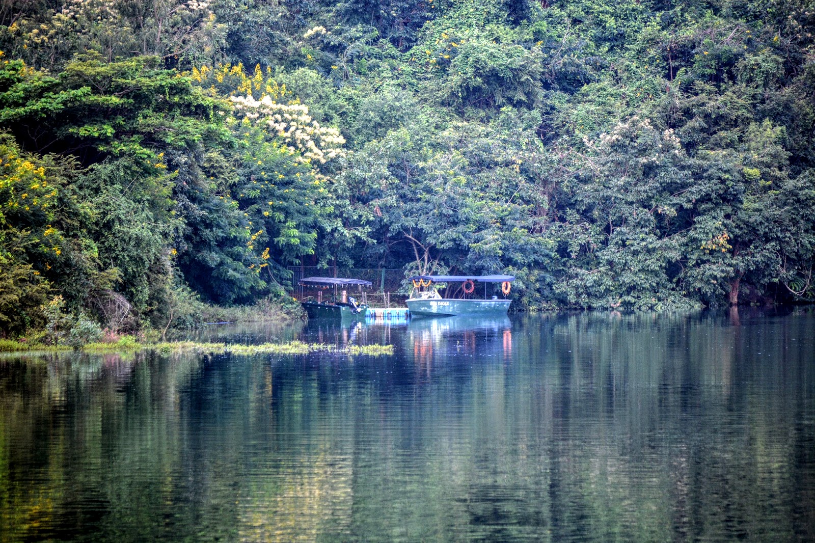
There is a lodge named River Tern, on the banks of reservoir (part of Jungle lodges and resorts Ltd). Its somewhat costlier than usual hotels and homestay's but definitely worth it.
 |
| River Tern lodge on the banks of reservoir |
From River Tern, we returned back to Tarikere and halted for 30 mins for breakfast. Then we took the route through mid forest mainway and then to the actual forest narrow way. We reached Kemmanugundi , as we don't have much time we skipped this. The main reason to come here is go to Chikmagalur via the forest route instead of normal route to enjoy the beautiful sceneries and mountains of Bhadra wild life sanctuary. There is a forest check post near Kemmanugundi. The guy told us that the road is in worst condition and you can not go. Since we knew before that the road will be very bad, we told him the same and asked us to allow. He noted down the vehicle number and no of persons, took 10 rs and allowed us.

The roadway to nearby Chikmagalur is actually 27 kms fromhere (Short route, right images), if you take the long route it will be around 60kms+ but the road will be good (left image)
Note : The short route is not suggested in maps but is visible, I had drawn the imaginary lines along the route for understanding purpose only.
Bhadra Forest
The best time of the tour. The road is bad as mentioned and you should be ready for a immediate service of your vehicle after your trip.
 |
| At Check post |
 |
| Damaged Roads |
 |
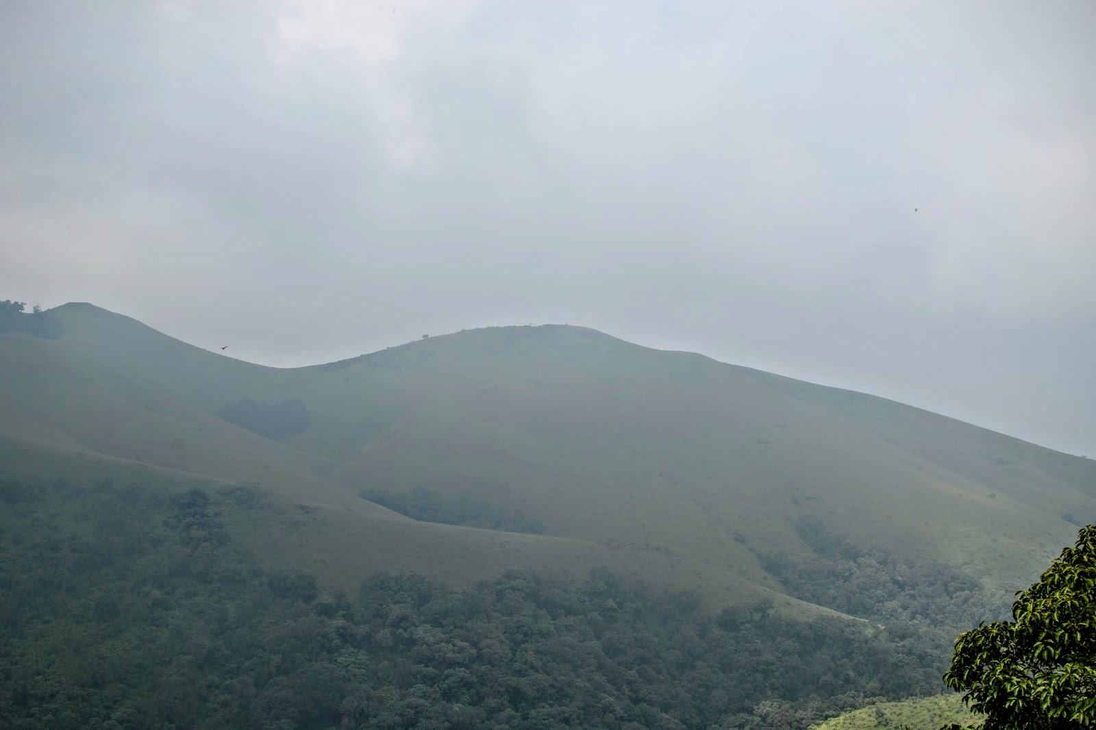
| En-route Baba Budangiri hills via Bhadra forest |
 |
| List of ayurvedic plant species naive to the Bhadra forest |
 |
| You can find such sign boards all the way in Chikmagalur tour |
 |
| Miniature effect |
 |
| Spectacular sceneries all the way |
Ride on two wheeler would be excellent but one should be careful because if any problems occurs like puncture, break down etc it will be difficult. The network coverage is moderate, sometimes you will get signals and sometimes you wont. You should also carry snacks and drinks as there is nothing available throughout the journey. Check out the photos and route maps
Baba Budangiri Hills
These are the second largest mountain peaks of Karnataka. There is holy place called " Shree Guru Dattatreya Baba Budan Swamy's Darga". Check the name carefully one more time.
Its actually place of interest for both Muslims and Hindus. People of both religions come here and offers pray to the baba Budan, a Sufi of 17th century who introduced the coffee plants to India (as per history with little evidence). The peak ranges from 1700-1890m height and the weather is always cool even in summer.
Jhari Waterfalls
From Baba Budangiri hills we started to Mullayyanagiri peak which is the highest peak in Karnataka (1900m approximately). En route Mullayyanagiri, we stopped at Jhari waterfalls and spent sometime over there in the water. You have to park vehicle on the main road and walk for at least 1km or trek for 500 steps down to the valley.
 |
| En-Route Jhari water falls |
 |
| Jhari Water Falls full view |
 | |
|
It is very exciting and adventurous to trek here as the way is slippery most of the times. The water is very cool, I assume the temperature is at least 10-12 degrees. The water falls step by step from the top and some people are over enthusiastic to reach the steps which is not recommended. This is really place to enjoy with family and kids. Check out the photos
Mullayyanagiri Peak.
This is the last trip of the tour. I am very much excited after hearing that road to the peak is very narrow and there is no protection at all for the vehicles. What I heard is true but it did not excite me as I thought since the place I am from (Srisailam) is also famous for narrow roads and hairpin bends. We are stopped by the police at Sitalayyana Mutt point.
There are large number of tourists and vehicles, narrow road without protection, they have no other way to stop everyone here at Sitalayyana Mutt Point. We parked our vehicle and the trekked for 200 feet to reach the peak. The view is spectacular and best time to visit is during sunset. We reached at sunset time but unfortunately its very much cloudy with little rain. The weather is thunder cool and breeze is so fresh.
We spent some 30mins time here. It would have been nice if we are able to make it to Mullayyanagiri peak :(
 |
| Route to Mullayyanagiri Peak |
Then we returned back to Chikmagalur, halted there for dinner break and started to Bengaluru at 8 PM. It took six hours and by the time we reached home, it is 2 PM. My suggestion is, cover the tourist spots early and start before 6 PM if you are from Bengaluru so that you will reach by before 12.
This is my very first article related to Travel, I tried to provide the accurate information based on my knowledge and personal experience. You are advised to do your own research before you plan. Any suggestions and feedback related to the article are highly appreciated, kindly let me know in the comments section.
Will update this article with videos later. You can find all the photos in full resolution here Chikmagalur Album Set
Note : Maps data retrieved from Here Maps by Nokia. All the photos are taken by me except the one I feature.
Camera used : Nikon D7100 equipped with 35mm and 55-200mm lens.
All are unedited images directly taken from the camera. The miniature, Silhouette effects are from camers software only. Some of the photos like the last ones are slightly enhanced by Google picasa software automatically after uploading to Picasa web albums.


