
Excited to write a travelogue after many years. Travelling to Munnar was in our mind ever since we moved to Bengaluru 5 years back. Frankly speaking, unlike Ooty or Waynad or Coorg, Munnar is far from Bengaluru to cover in 2 days and also expensive to hire a vehicle and go. Since, we got our own vehicle last year, we decided to do the trip by self driving. We planned the whole trip for around 3 and half days including the travel time. All Photos in this travelogue at high resolution can be found at https://photos.app.goo.gl/aPeQt5u7T7caxZsv1
Trip Plan
Day-1
Bengaluru - Coimbatore via NH-44 and NH 544(Overnight stay) Map Link
Day-2
Coimbatore - Isha Spiritual Center - Coimbatore - Athirappilly waterfalls via Palakkad and Thrissur Map Link
Athirappilly Waterfalls to Ponmudi (Ragamaya Resorts, 30 km from Munnar Town, Idukki district) Map Link
Day-3
Ragamaya Resorts to Eravikulam National Park (Via Munnar town) Map Link
Eravikulam National Park to Top Station via Echo point and Mattupetty Dam Map Link
Top Station to Ragamaya Resorts Map Link
Day-4
Ragamaya Resorts to Hanging Bridge Map Link
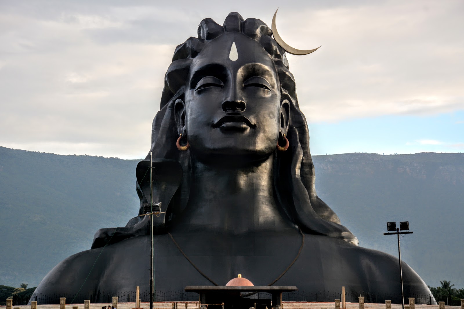
We started our journey on Thursday afternoon around 2PM from Bengaluru, packed eatables from Cakewala as a backup. We took the national highway 7 (NH44 or AH-43) till Salem. The road is scenic especially just before reaching Salem and then we took diversion to Coimbatore via Erode and Tiruppur (NH544). The road till coimbatore is completely four lane but has tolls. We reached Coimbatore by 8PM and checked-in to our hotel. We booked a budget hotel (Hotel Fortune, 1500rs/ night) since we just wanted it for an overnight stay. We checked out the next day morning around 6AM and proceeded to Adiyogi statue at Isha Foundation. The hotel staff at Fortune were very accommodating to provide us breakfast (cut fruits and sandwiches) early in the morning. It takes around 45mins to reach the place. The location is serene with Araceceae plantations (palm trees) and Velliangiri hills of western ghats in the background pulling the clouds.

and then the world's largest bust sculpture (112 feet tall, ~500 tonnes steel)

depicting Adiyogi (the first or oldest yogi on earth) i.e. lord Shiva, beautiful sculpture


We could not visit the other places at Isha Foundation in the interest of time. We proceeded straight to Athirappilly water falls in Thrissur district of Kerala. The road to Thrissur via Palakkad is a highway. It's a 4 lane road till Palakkad, but things worsened after crossing Palakkad. The highway was under major renovation (Sep, 2017) and it almost took 2hrs to reach Chalakudy, from where Athirappilly is ~30kms or 45min. The road condition is well maintained, but be careful with the S curves and hairpin bends. We could not resist to put our Vento on sports mode in the forest area. In total, it took 3:30 from Coimbatore to Athirappily !


One has to walk around 0.5km to reach the falls and the actual view of falls is as seen above. If you want to see the falls from bottom, you need to trek down another 0.5km and it will be worth doing so. See the pics below.


It will take at least 3 hours if you want to get into water and relax for some time. There are no proper hotels or restaurants nearby, all you can get are packed foods or fruits only. Hence, plan your trip accordingly.
We started from Athirappily to our resorts i.e. Ragamaya Resorts and Spa . The route was in very bad condition and our sedan had tough time with all the potholes on the way to resorts. A thrilling event happened when we were about to reach the resorts. The google maps navigation took us to a hanging bridge in the forest. The bridge, seen from inside of the car with headlamp on amisdt the deep darkness, reminded us of some of the horror movies. The water stream sound below the bridge still echoes in my ears. We were not sure whether the bridge can bear the car weight or not. My brother got down and walked on to the bridge. He returned to the car telling us that the water stream sounds might be from a deep valley. When we were clueless of what to do, to our rescue a car has come from the other side and the driver assured that the bridge can handle one car at a time. The bridge was swinging gently when we were on it pumping our adrenaline levels. With the help of a locals, we reached our resort by 9 PM.
Day-3
We woke up to a stunnig view the next day morning at 6 AM.


After an hour or so we had an authentic Kerala breakfast (complimentary) in the in-house restaurant with a view 👌


After a delightful breakfast, we headed straight to the Eravikulam national park. It took 2 hours to reach there as the road condition was very bad but scenic throughout.

 |
| A beehive at Eravikulam National park entrance |
 |
| Glimpse of Anamudi peak from park entrance |
The park is located around the highest peak in south india - the anamudi peak (2695m). Private vehicles are allowed only till the park entrance and one has to take the bus service provided by Kerala forest department. Only a limited number of visitors are allowed per day (2000 no.). Reaching there early there before 11 is advised in view of the restricted entry. It take around 20mins to reach the last point from where one has to walk around 2-3 kms to reach the peak. The picturesque mountainous views are probably the best in entire tour. The park is famous for the species Nilgiri Thar (Nilgiritragus hylocrius). See the photos below
 |
| Picturesque Western Ghat mountainous ranges as seen from the Anamudi peak base |
 |
| Nilgiri Thar |

 |
| Anamudi, the highest peak in south India with elevation of 2695m. The top point is not reachable. |
It took around three hours for this total trip. Plan to carry some snacks although plastic is totally banned from the entrance (Forest officials check bags before boarding bus).
After the exhausting Eravikulam national park tour, we headed to the Mattupetty reservoir. Nothing interesting here but has reservoir in the mountains backdrop and is less crowded.

 |
| Mattupetty Reservoir |
After spending an hour, we proceeded to the "Top Station". Top Station is right at the border between Tamilnadu and Kerala. The views are as splendid as the route. We thoroughly enjoyed the drive. I heard that the view from other end of the mountain is even better but not sure of reaching there.
 |
| View from Top Station |
 |
| Tea Estates enroute Munnar from Top Station |
 |
| Love birds in the tea estates |

Day-4
We reserved day 4 for relaxation at the resort. The early morning views as usual were spectacular with fog covering the forest, birds making sounds, nature at its best.

 |
| Can you spot the bird ? |
Remember the hanging bridge I mentioned in the Day-2 trip when we were tryng to reach the resorts ? We wanted to see how big the hanging bridge and valley depth beneath are. It is around 8kms from the resort. The bridge was constructed during British era and it's solid even now. During vehicle movement one can sense the vibrations and movement though. Only one vehicle at a time is allowed.


After spending half an hour at the bridge, we returned to the resort. The swimming pool was a scenic and great place for relaxation.

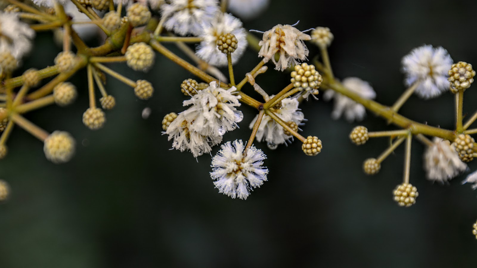
We checked out the resort at 11 AM before picking up the head ginger plants. A beautiful plant originated in South America that maintains a symbiotic relationship with ants. Luckily, even after ducking them in the car boot for more than 10hrs, the plants survived and started blooming after 3 months.

If you like this Travelogue comment below and share the article.......
Article jointly compiled by my brother and me.

2 comments:
Great work and time spent...keep posting.
Thanks for the article. Very well written.
Post a Comment